
PerSav – An App to support people with disabilities to travel safely and independently
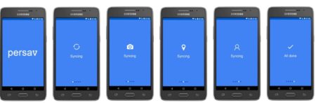
The PerSav app aims to support people with disabilities to travel safely and independently. PerSav is short for “Personal Sat Nav”. It is an app, under development by National Learning Network Limited, the employment and training division of EPR member Rehab Group. The app will be available for mobile phones as it has been positively tested in iOS and Android versions.
Although originally focused on supporting people with mobility impairments, the team developing PerSav thought in the App working for other groups with different needs, including but not limited to people with brain injury, early onset dementia, people on the autism spectrum or people who experience anxiety during trips. As the funders asked developers to focus on one of these target groups for now, the group that have shown the greatest potential benefit/interest are people with brain injury.
How does PerSav work?
When you download PerSav, it connects to whatever mapping app is on your phone, i.e. Google Maps. You can then ‘drop’ icons onto the map of where you are right now to illustrate an issue that you have to deal with during your journey. It might be construction works, a steep slope, steps without ramps, an uneven path, a busy and complicated junction to be avoided… By dropping icons from a menu in PerSav, you can help build up a picture of the area that will benefit not just you but every PerSav user. Over time a detailed picture of where the issues are for people with disabilities will emerge. This can be used as evidence in consultations with local authorities and transport providers. It can be also used to explain business owners that leaving bin bags or signs on paths is a problem. The App will let you look at new destinations and plan new trips, using routes that avoid the problems identified by other PerSav users with similar needs to the user.
The real key to PerSav lies in recording personal journeys. These are journeys that a user make regularly on their own, perhaps with a friend or care assistant. The App allows the user to drop icons on the route, this set of icons illustrates what to do at these locations or way points. These could be junctions or points on the route where the user may want to turn right, cross the road etc. Once the journey is being defined to and from a destination i.e. “college” recorded, they can be saved into a private encrypted folder. When the user leaves home to travel to one of the destinations, they can just select it on PerSav. The App then tracks the user’s progress against that route using GPS coordinates. PerSav can help by triggering supports linked to the icons dropped on the route. These supports can be generic or personal and specific to the user. They can be icons or text (or audio). If the user get lost or delayed, PerSav will text and email an alert to the safety team.
The safety team- This team is made up of people the user trust: – family members, friends, neighbours and/or a key worker. They can view the alerts in real time and if required they can contact the user to check if they are well or just talking to a friend or popped into a shop to buy something!
The HELP NOW button- The third feature on every PerSav screen is a “HELP NOW” button, which helps making a call to a safety team lead. PerSav will send them the user’s GPS coordinates in a high level alert, but above all, the user will be free to talk to someone immediately. They can then help them resolve whatever issue has arisen.
If PerSav can support people with brain injury in your services to achieve a greater quality of life and if you would like to explore this further, please contact Kieran by email at kieran.hanrahan@nln.ie.
-
EQUASS
The European Quality in Social Services (EQUASS) is an initiative of the European Platform for Rehabilitation (EPR). EQUASS enhances the social sector by engaging social service providers in continuous improvement, learning and development, in order to guarantee service users quality of services throughout Europe.

-
 This website received support from the EPR framework partnership agreement with the European Commission, DG Employment, Social Affairs and Inclusion for 2018-2022 from the EU Programme for Employment and Social Innovation (EaSI). For further information please consult: http://ec.europa.eu/social/easi